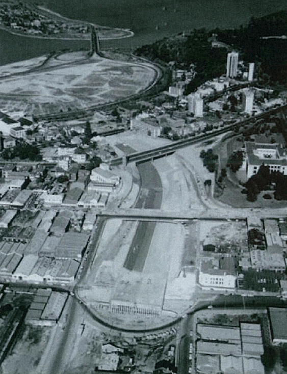

Mitchell Freeway construction 1968. Can you spot Parliament House?
Originally published in the West Australian. The writer was a guest for some, not all, of those mentioned in the story below. This story was also broadcast on 6PR.
Part I
Looking at what lies alongside the freeway is not unlike the journeys we make to further flung destinations; we look for something new, we seek an experience and we feel better for it.
Alongside the Mitchell and Kwinana Freeway there is spectacular and pristine bush with innovative rehabilitation and sanctuary programs. There are wetlands, coffee strips, museums, historical icons, playgrounds and of course, Western Australia’s Parliament House.
The Perth Metropolitan Scheme of 1955 resulted in the construction of the Narrows Bridge and its far reaching freeways. Along the way, northbound and southbound, there were suburbs and communities divided and bushland demolished.
The 30km Mitchell Freeway runs from just before the northern side of the Narrows Bridge and currently ends at Burns Beach Road in Joondalup with a new extension approved and imminent. The Kwinana Freeway is 72 kilometres long, running south from the Narrows Bridge and becomes the Forrest Highway from Pinjarra Road.
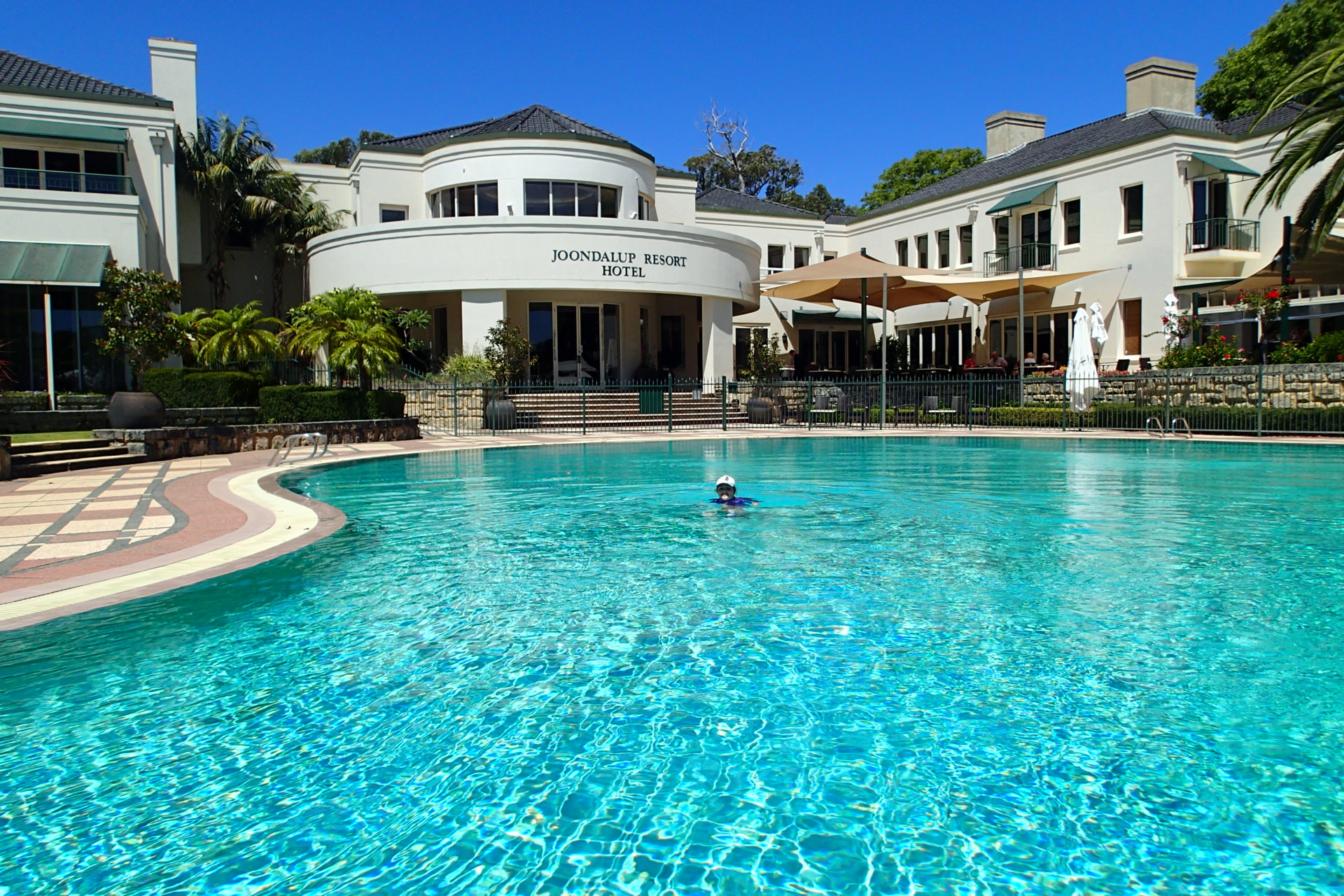
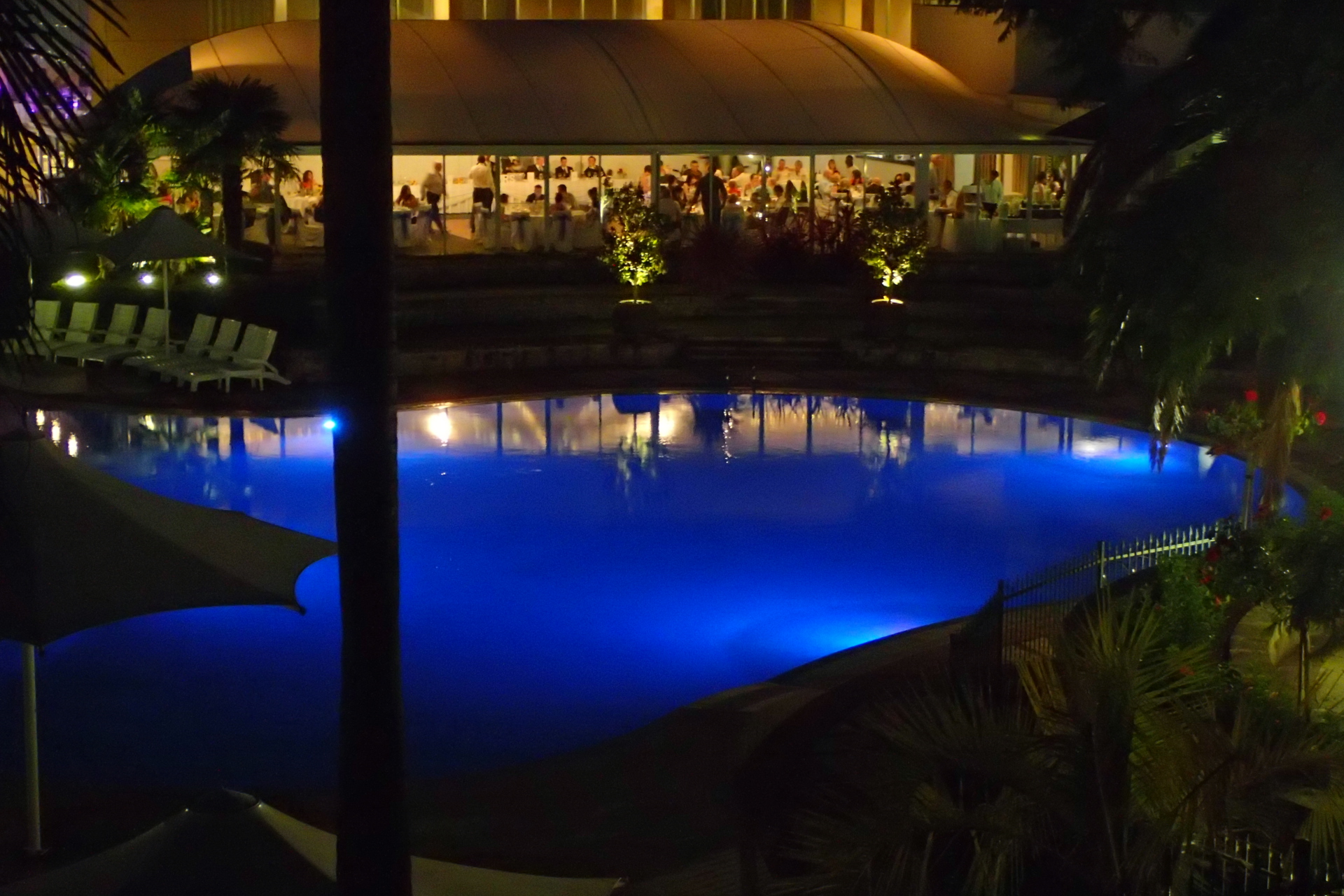
I begin my Freeway travels by starting from the north at the Joondalup Resort. Just a minute from the Mitchell Freeway off Hodges Drive, this resort is encircled by a world class golf course with resident kangaroos at sunset. Accommodation is befitting the best that we fly to Bali for and many rooms overlook a very impressive resort pool. Sitting on your balcony at night you can watch as the pool becomes a mood light, cycling through a variety of hues while newly married couples seek yet another photo opportunity by its edge.
Travelling south, my next stop is off Ocean Reef Road and is a sprawling series of wetlands that make up the Yellagonga Regional Park, over 1400 hectares listed by the Western Australian Government as ‘Bush Forever’. A strong community program led by the City of Joondalup is improving awareness of responsible pet management, prevention of hand feeding wildlife and increasing feral animal awareness to ensure birdlife, reptiles and amphibians are thriving.
Just a short way south and on the other side of the freeway is the Craigie Bushland which has significant conservation value. In 2008 the City of Joondalup supported a proposal to develop a conservation sanctuary within the bushland to protect native animals and plants. A feral-proof fence has been completed and surrounds just over 40 hectares of the 53 hectares of bushland.
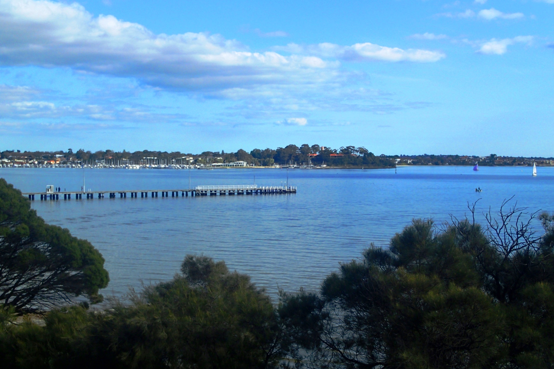
Next stop is the beautiful double act of Lake Monger on the western side of the Mitchell Freeway and the café strip of Leederville alongside the freeway on the eastern side. Getting off at Vincent Street I decide I will look at Lake Monger first.
Lake Monger is a wetland habitat for many birds but it’s the numbers of black swans that get the cameras out for the tourists, particularly on the northern edge of the lake where photos of the swans will also capture the city skyline behind. Lake Monger is also a popular exercise habitat for people who walk, run and ride their way around the 3.5 kilometre track that surrounds the lake. Just keep one eye open on the archery group that like to send a few salvos into targets on the western side.
Two minutes’ drive away is the Leederville café strip, perfect for a range of refueling and retail therapy at any time of the day and late into the night. A popular recent addition is the timber decked pop up alfresco area that occupies a few car bays and is regularly moved along the street to reside outside one of the numerous cafes or restaurants. Families can enjoy the nature playground at the bottom of Oxford Street with its popular shaky plank walk.
The last stop for my Mitchell Freeway experience is a trio of attractions, two of which are particularly well known and the other a bit less known. Firstly, Western Australia’s Parliament House. In the Stephenson Plan for the Perth Metropolitan Area part of the justification for putting the freeway through the Barracks included that the Barracks blocked the view of St Georges Terrace for politicians looking down the Terrace and the people of Perth from looking up the Terrace at Parliament House. A survey in 1966 by The West Australian recorded nearly 10,000 votes in favour of saving the Barracks and less than 1500 against.
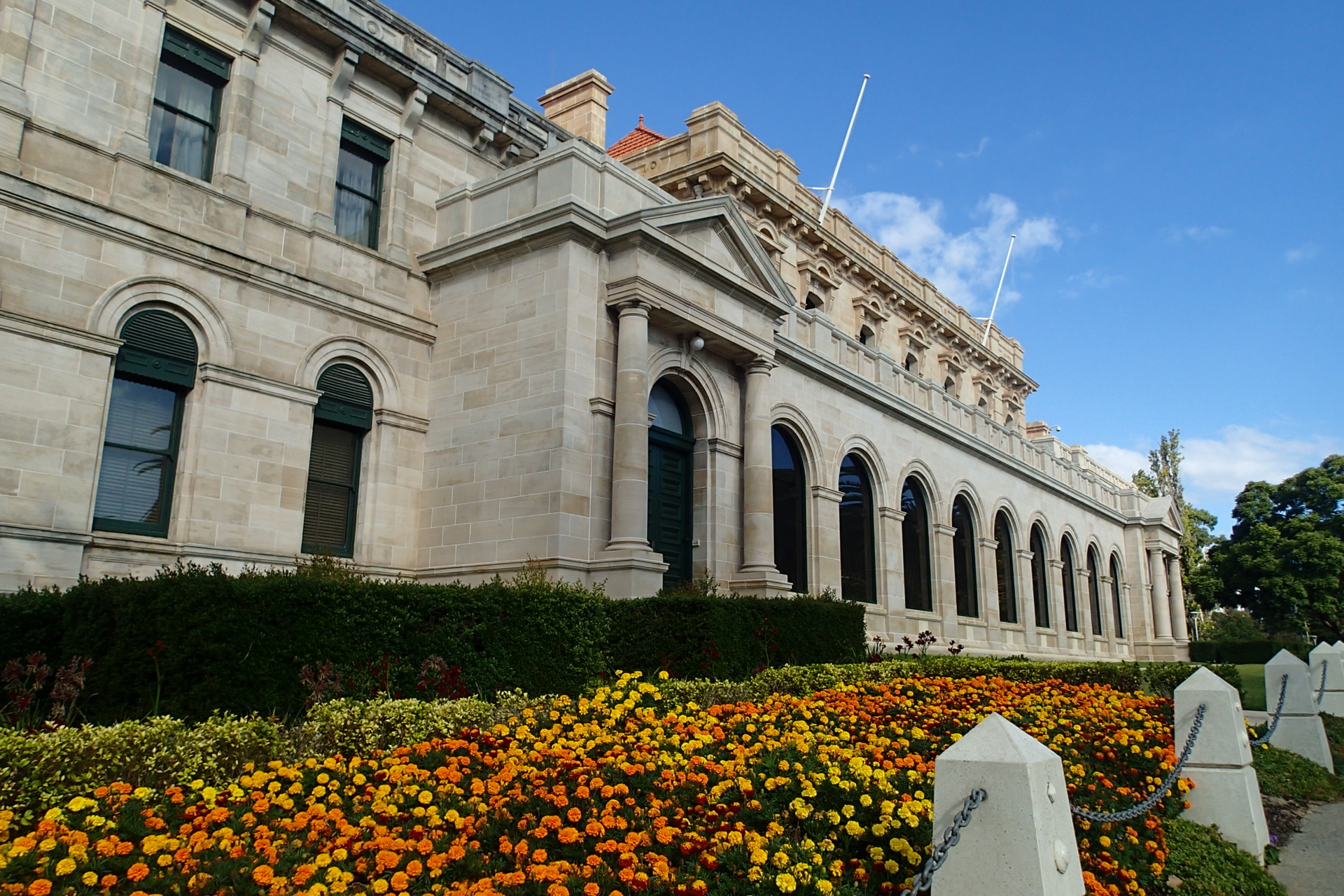
Surprisingly easy parking is available at the front of Parliament House and the security is friendly about photos being taken of this impressive building. While construction commenced in 1902, the eastern façade we are most familiar with was built in the early 1960’s. It’s the western side of the building on Harvest Terrace that I love looking it. It was the original front of Parliament House and has a grace and distinction that deserves more attention. Public tours are available on Monday and Thursday mornings and the tour experience is dependent on whether Parliament is sitting.
Walking across nearby Malcolm Street and down Cliff Street I head down Jacobs Ladder, the fitness icon of the city. This steel and concrete structure attached to the 43 metre cliff face looks like a giant slinky and is just over 240 steps. Make sure you keep to the left or you’ll be flattened, pummeled and trampled by those getting fit and staying fit.
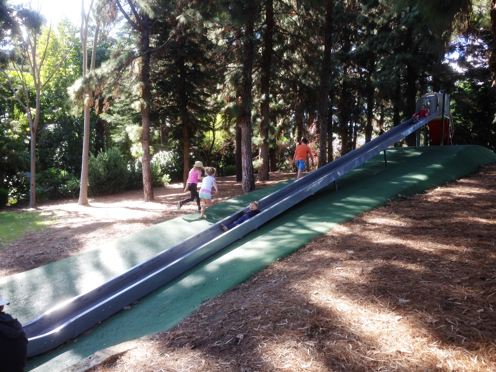
Before venturing to the southern side of the river I have a final stop to make that is adjacent to the busiest road network in Perth. Alongside the freeway, the on and off ramps into the city, Mounts Bay Road and literally a one minute walk from Jacobs Ladder is John Oldham Park. Featuring enough vegetation to deaden the noise of traffic and block the city from view, this park also has enough water to attract a variety of wildlife, a wonderful shaded waterfall feature, a series of small pedestrian bridges and a playground for the kids, including what must surely be the longest playground slide in Western Australia. During the week you’ll see plenty of office workers from the nearby cbd just enjoying the tranquility of the green shady paths. On weekends it’s families who are discovering the BBQ facilities and easy parking that make this a real surprise packet for those looking for a new park experience.
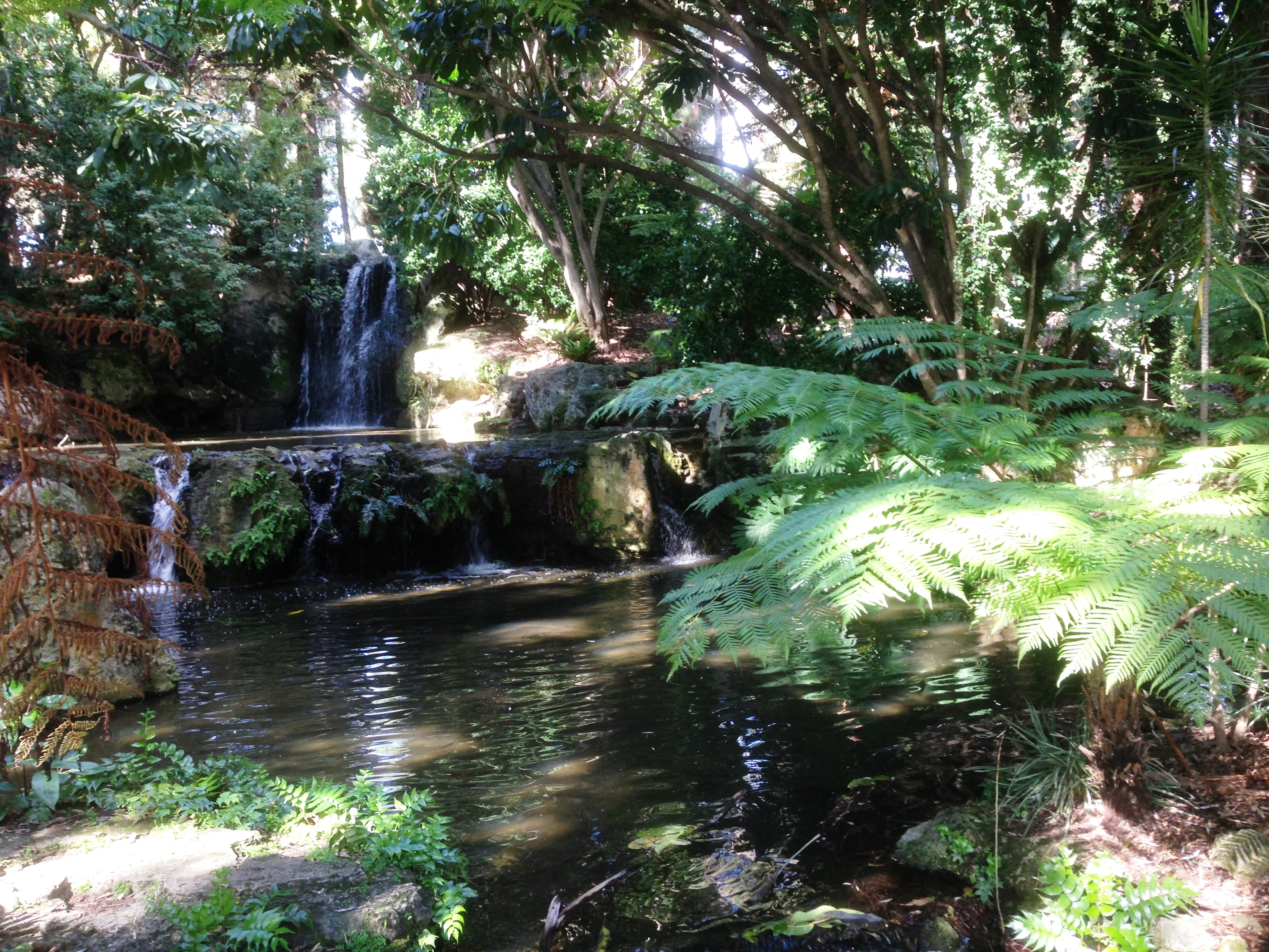
Above and Below: Oldham Park, tucked away from the nearby world of hustle and bustle.
Part II
As I cross the Narrows Bridge, built in 1959, duplicated in 2001 and then adding a railway bridge in 2005, I leave the Mitchell Freeway behind and begin travelling on the 72km Kwinana Freeway.
No sooner have I got on when I get off. I’m visiting the Old Mill, undoubtedly one of the best known landmarks in Perth but perhaps feeling a little neglected by the public in recent years. Built in 1835 it was a fully operating flour mill for over twenty years and subsequent guises saw it operate as a hotel and even a poultry farm. It’s open to the public with guided tours available most days of the week.
From the Old Mill I walk across Mill Point Road to see if anyone is fishing under the bridge. There are some dads teaching sons how to cast a rod and sons eyes that keep being distracted by Rottnest bound ferries, jet boats and a convoy of kayakers.
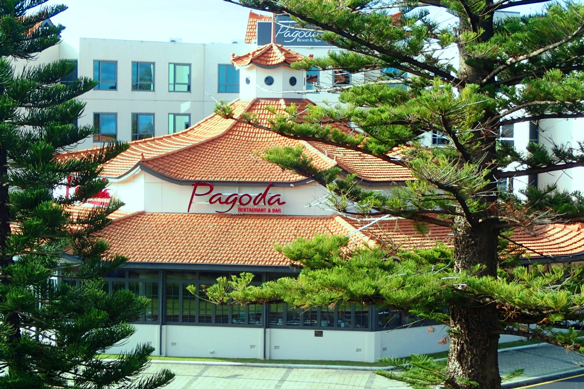
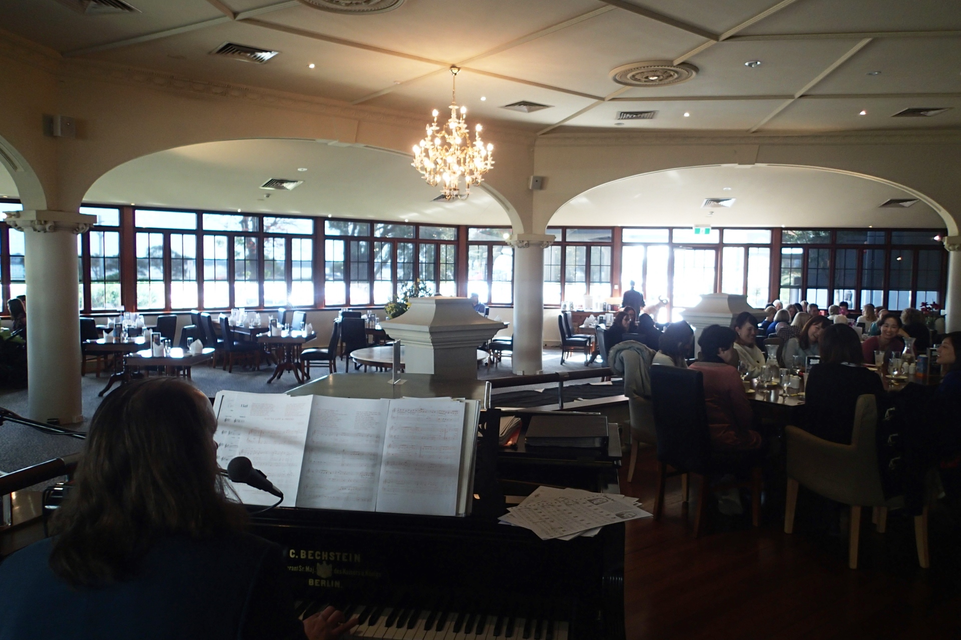
Just up the road from the Old Mill is the octagonal Pagoda, a Perth landmark and cultural institution. Described as ‘Edwardian Oriental’, most of the activities it’s famous for are as bygone as the era it was built in; ballroom dancing, roller-skating and jazz music. Its current guise as a restaurant lends a welcome opportunity to enjoy lunch before exploring more of the highlights of the Kwinana Freeway. As it’s a Sunday, I am fortunate to time my lunch with the Pagoda High Tea.
There’s a pianist caressing the keys in tune to the clinking of tea cups and champagne flutes. It’s over 8 years since I was last at the Raffles in Singapore but I’m reminded of it now. The long bar and striking architecture is elegant and I regret it’s taken me so long to experience this Como treasure.
After a fantastic lunch there’s an easy stroll over the nearby pedestrian bridge to Como Jetty. I love jetties. There’s life on a jetty, if not on top then always underneath. There are people fishing, taking selfies with the river backdrop, a pelican on a light pole and barnacles and mussels underneath.
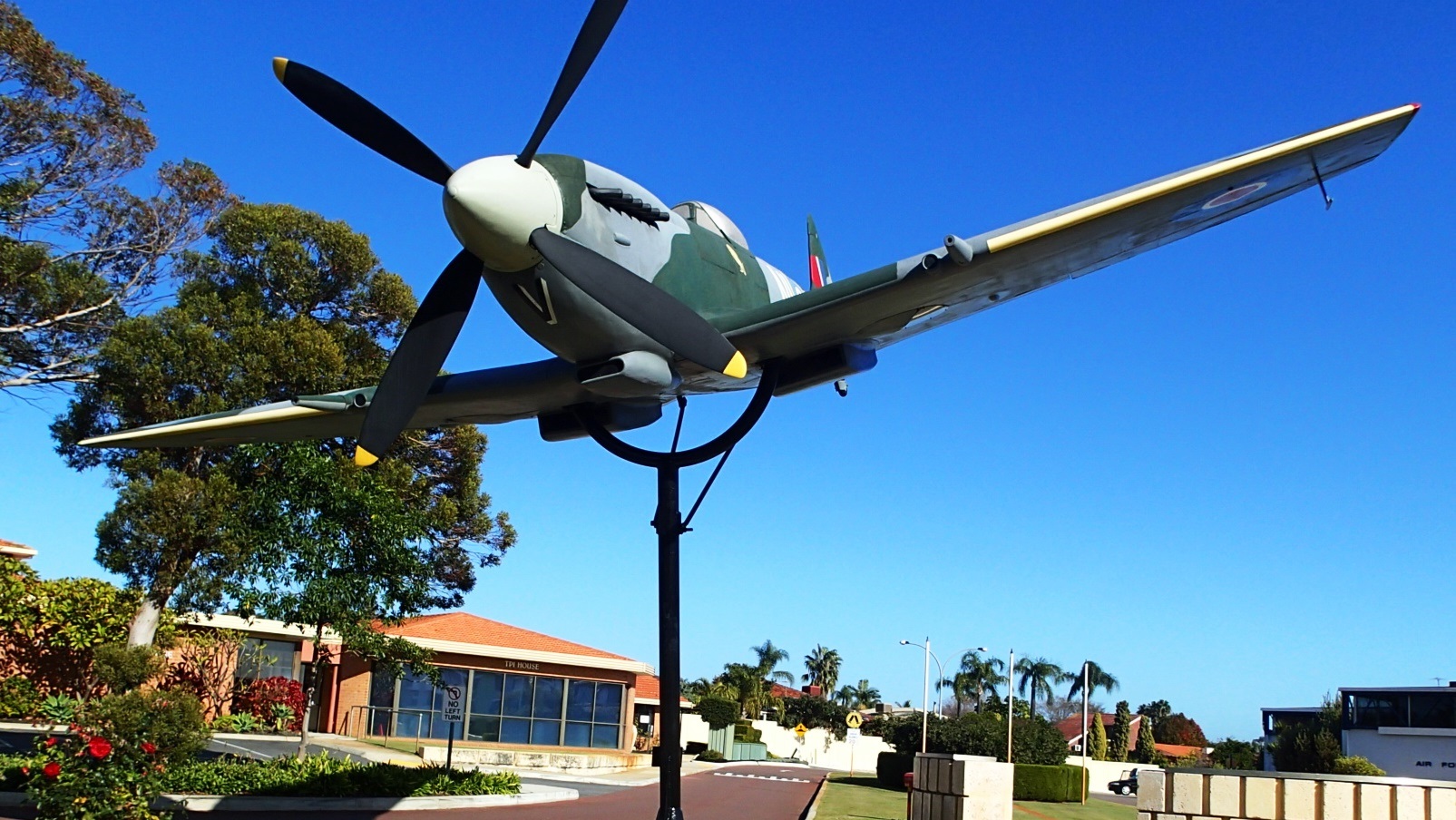
Back on the freeway and just past the Mt Henry Bridge I take the Leach Highway exit. The Aviation Heritage Museum is less than a minutes drives from the off-ramp. With a Spitfire out the front that is mounted on a stand like a giant Airfix model you’re already smiling as you walk through the front doors. The museum is full of civilian and military aviation history including more than 32 aircraft.
A Catalina flying boat to the right, a DC3 Dakota on the left and that’s just in the front shed. In between the two big sheds there’s a CSIRO rocket aimed at the moon and in the bottom shed is the massive Lancaster, another Spitfire, Canberra bomber, Vampire and Macchi jets and so much more. Get there at the right time and the volunteers will start up a Merlin engine for you (as long you agree to wear ear protection) and you can even arrange for a tour inside the Lancaster.
My next stop is on the other side of the freeway off the Anketell Road exit. The Spectacles, within the Beeliar Regional Park, has spectacular Banksia woodlands and a track that allows options for short and long walks. The wetlands within the park contain great diversity in flora and fauna, including the formidable Banksia, bronze mushrooms, snakes and very big spiders with even bigger webs.
The Spectacles wetland area covers nearly 4 square kilometres and got its name from its perspective from the air where the two lakes are connected by a drain. Continuing work from local volunteer groups is seeing the wetlands accessibility and interest increase with boardwalks and information boards.
Every third Sunday morning of the month The Friends of the Spectacles gather at the Spectacles to relocate irrigation pipe for Banksia rehabilitation, weeding and other activities including a sensational morning tea that was more like a growers market.
The final stop on my freeway travels is Yalbanberup Pool which is part of the Serpentine River and accessible from Mandjoogoordap Drive.
Yalbanberup Pool is part of the Serpentine River. It’s a quiet spot and many kayakers on the river find it’s a good half way stop between Guananup Pool to the north and Goegrup Lake and Black Lake to the south. Without the sound of paddles gently slapping the water there’s not much else you’ll hear other than the lapping of small waves on the shore if the breeze is up. The banks are lined with a variety of tall grass, tea trees, sheoaks and paper barks shedding swathes of soft white bark.
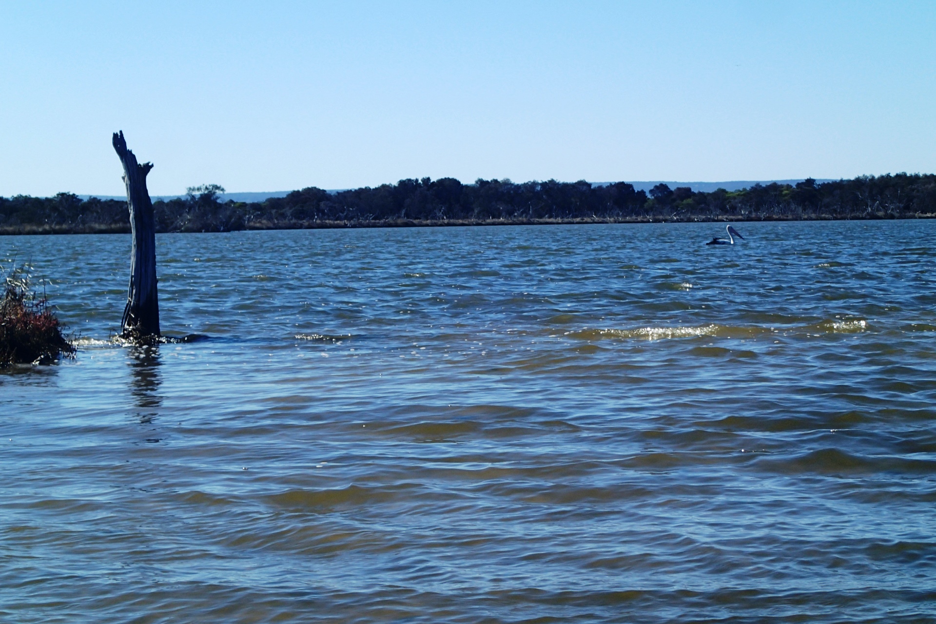
Above: Yalbanberup Pool
A short drive south brings me to the Murray River and Pinjarra Road exit off the Kwinana Freeway and the end of my freeway travels. Beyond this point is the Forrest Highway, leading into Bunbury.
In the 1950’s Perth traffic congestion at the Causeway end of South Perth and Victoria Park was one of the reasons for the push to build the Narrows Bridge and freeway. Another option favoured at this time was to put the freeway down Barrack Street and over the river to Mends Street. By the 1960’s work was well under way to construct the freeway and in 2015 the work still continues to lengthen and widen it wherever possible.
There’s an old joke about ‘family’ not being a word but a sentence. Perhaps this joke applies to ‘freeway’ as well. It’s here to stay and just seems to get busier by the day.
Finding out what’s on either side of it is part of the relationship and travel experience you can have with it. Sometimes we all just need to get off the commuting carmageddon and see what’s out there.

Leave a comment